Land at West Langton

Dunlop, East Ayrshire, KA3 4BL

Offers Over £650,000

152.75 acres

  • An excellent block of land located within an accessible location.
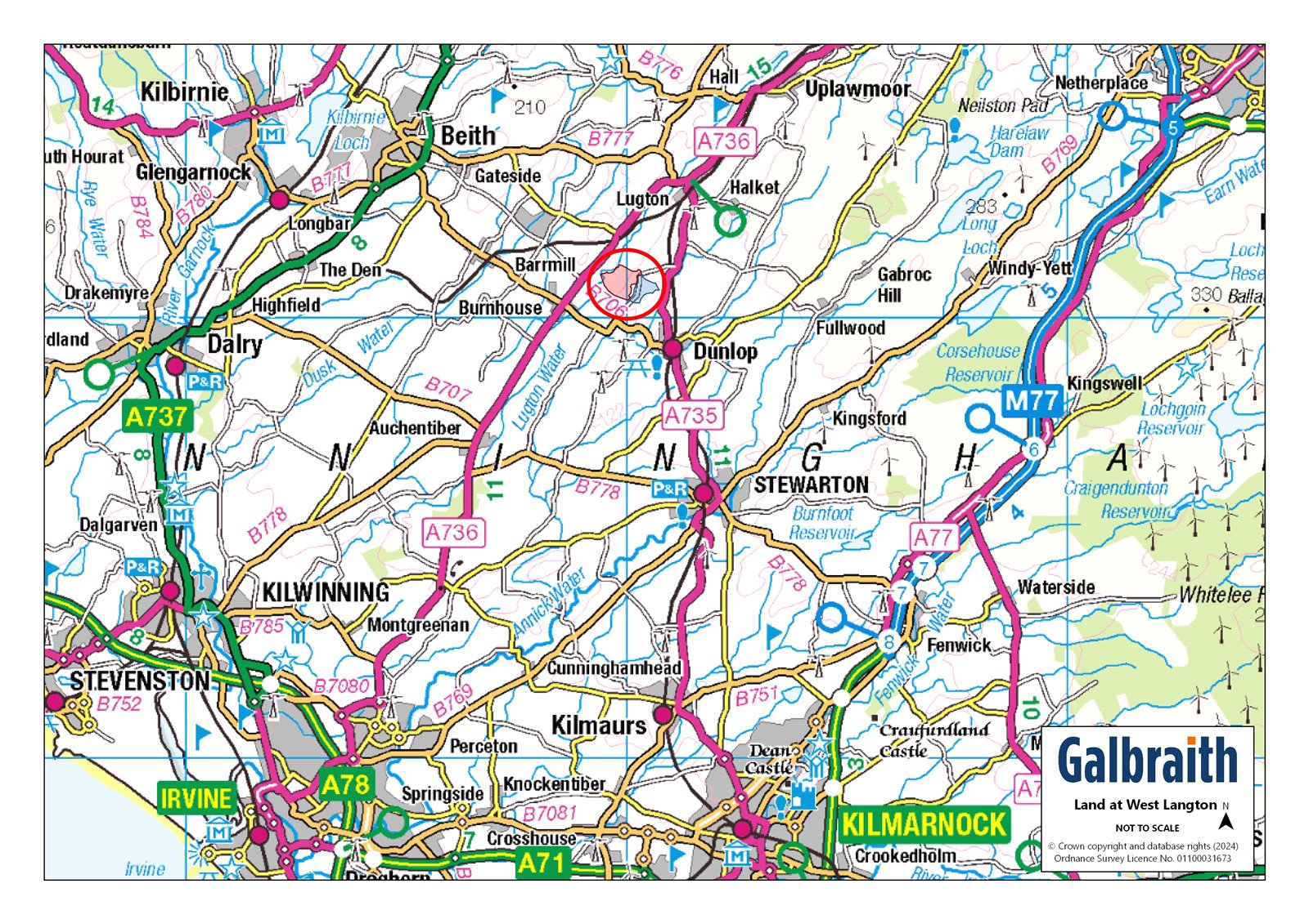
  • Glasgow 17 miles.
  • About 152.75 acres (61.81 hectares) Grade 4(1)
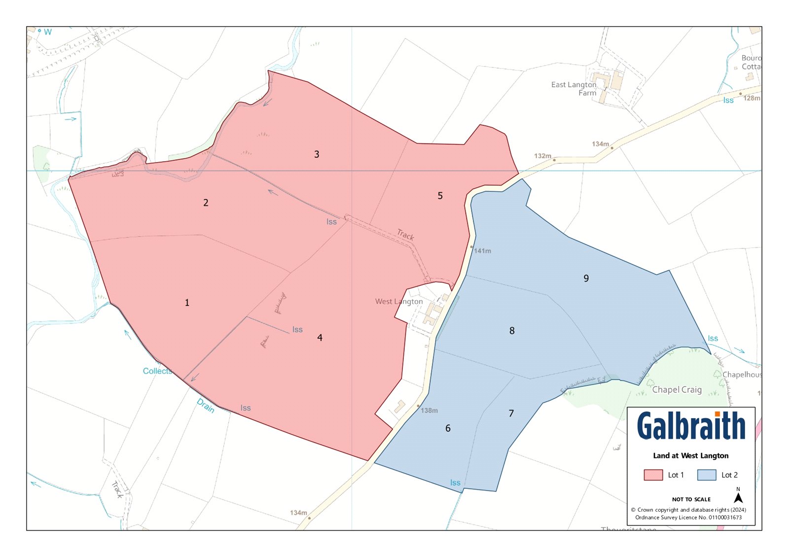
  • For sale as a whole or in 2 Lots.
  • Lot 1: 41.67 Ha (102.98 Ac) of land.
  • Lot 2: 20.14 Ha (49.77 Ac) of land.

The Land at West Langton is situated close to the village of Dunlop in East Ayrshire.The land at West Langton extends in total to approximately 152.75 Ac (61.81 Ha). The two blocks are bisected by an unnamed B-road which adjoins the B706 to the south and Dunlop Road to the northeast. All the land is graded by the James Hutton Institute as Grade 4(1) and is used for grazing and silage purposes with cereal crops being grown historically. All the land is serviced by a mains water supply. The majority of boundary fencing is in a stock proof condition. The land is of good quality, capable of producing numerous silage crops throughout the summer months. The land is currently rented out on a seasonal basis with vacant possession being available from November 2024.Lot 1The land within Lot 1 which is situated to the west and extends in total to 41.67 Ha (102.98 Ac). There is a private access track that adjoins the unnamed B-road which provides access to the remaining fields located furthest west (marked 1,2 & 3 on the plan). There is also a cattle race area located off this track. The land rises from 91m to 141m above sea level.Lot 2The land within Lot 2 extends to 20.14 Ha (49.77 Ac) in total and is situated to the east of Lot 1. This block of land rises from 129m to 142m above sea level. All four field parcels can be accessed direct from the unnamed B-road.METHOD OF SALEThe land is offered for sale as a whole or in 2 Lots.IACSThe land is registered for IACS purposes. Entitlements are available by separate negotiation.NITRATE VULNERABLE ZONE (NVZ)The Land at West Langton is not included within a Nitrate Vulnerable Zone.LESS-FAVOURED AREA SUPPORT SCHEME (LFASS)All the land has been designated as being within a Less Favoured Area (Severely Disadvantaged).SCOTTISH GOVERNMENT RURAL PAYMENTS AND INSPECTIONS DIRECTORATERussell House, King Street, Ayr, KA8 0BE Tel 01292 291300MINERALSThe mineral rights are included in so far as they are owned.TIMBERAll fallen and standing timber is included in the sale as so far as it is owned by the seller.SPORTING RIGHTSIn so far as these rights form part of the property title they are included within the sale.DEPOSITA deposit of 10% of the purchase price shall be paid within seven days of completion of Missives. Deposit will be non-refundable in the event of the purchaser failing to complete for reasons not attributable to the Seller or their Agents.ACCESS/THIRD PARTY RIGHTS OF ACCESS/ SERVITUDESWe understand that there is mains gas pipe that crosses the land which is on a servitude agreement. There are also poles and stays crossing the land which are on wayleave agreements.DIRECTIONSFrom Glasgow city centre proceed west on the M8 motorway and take Exit 22 onto the M77. Continue the M77 and take Exit 3 and head west on the A726 for Paisley on Nitshill Road. Turn left onto the B773 Parkhouse Road. Continue through the roundabout and along Barrhead Main Street. From Barrhead continue the A736 for about 6 miles traveling past Uplawmoor, remain on A736 into Lugton, take the A735 (Dunlop Road) due south out of Lugton. Follow this road for around 1.3 miles then turn right and follow the unnamed B-road for around 0.4 miles and the land will be on both sides of the road.POST CODEKA3 4BLWHAT3WORDSTo find this property location to within 3 metres, download and use What3Words and enter the following 3 words: ///foggy.lives.rudderSOLICITORSMackintosh & Wylie LLP, 23 The Foregate, Kilmarnock, East Ayrshire, KA1 1LE.LOCAL AUTHORITYEast Ayrshire Council, Council Headquarters, London Road, Kilmarnock, East Ayrshire, KA3 7BU T: 01563 554400VIEWINGSStrictly by appointment with the Selling Agents.